English
 Español
 Deutsch
 日本語
日本語 Polska
 Français
 中國
中國 한국의
한국의 Українська
 Italiano
 Nederlands
 Türkçe
 Português
 Bahasa Indonesia
 Русский
 हिंदी
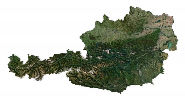
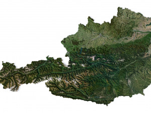
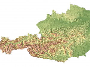
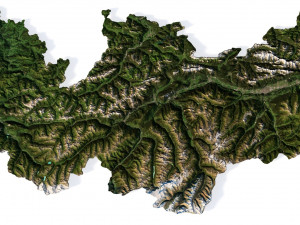
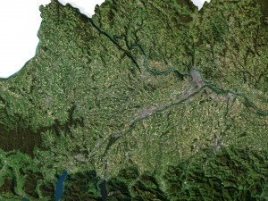
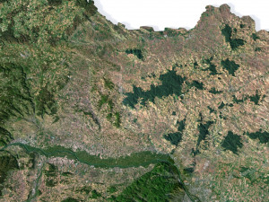
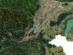
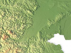
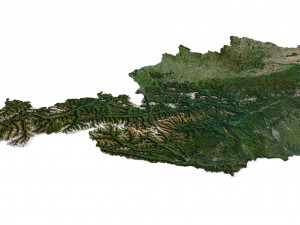
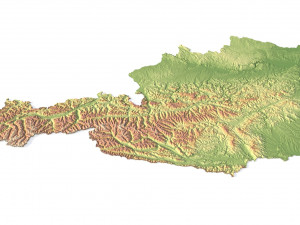
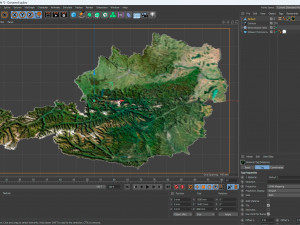
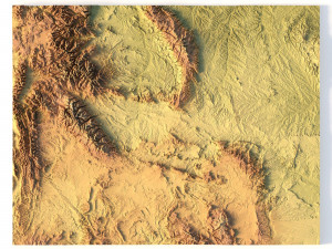
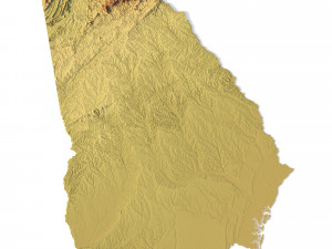
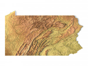
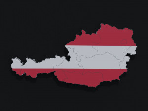
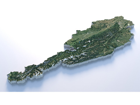
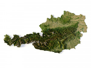
हिंदीAustria Terrain 3D Map Model 3D

- Format yang tersedia: Cinema4D: c4d 725.94 MB
Memberikan: Standard
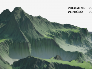
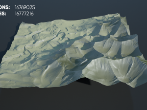
- Poligon:9 986 528
- Sudut:4 997 745
- Animasi:No
- Bertekstur:
- Dimanipulasi:No
- Material:
- Low-poly:No
- Koleksi:No
- Pemetaan UVW:
- Plugin Digunakan:No
- Siap Cetak:No
- Pindai 3D:No
- Konten Dewasa:No
- PBR:No
- Geometri:Polygonal
- Unwrapped UVs:Unknown
- Tampilan:2289
- Tanggal: 2023-07-12
- ID Barang:454172
- Peringkat:
Format: C4D
File size (unzipped): 571 MB
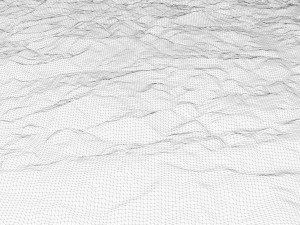
Polygons: 9 986 528
Vertices: 4 997 745
Geometry: Polygonal Tris only
Model size: 1500 mm x 800 mm x 10.873 mm
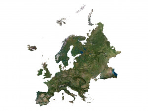
Projection: Mercator
Base: Open
UV layer: Yes (frontal)
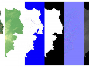
Textures
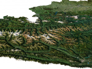
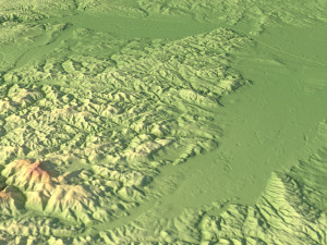
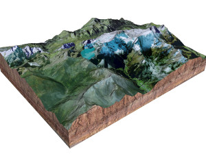
Height Map TIF 8192*4369*16b - You can use this map in the displacement channel instead of the polygonal mesh.
Normal Map TIF 8192*4369*48b - Use this map to reveal fine details of the relief.
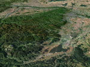
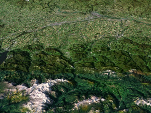
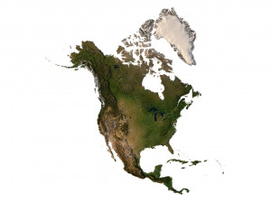
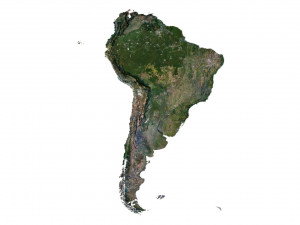
Satellite Map TIF 12000*6400*24b
Water Mask TIF 12000*6400*24b - Use this map for masking in the Reflection channel to get glare from the water surface.
Pseudo-color Map 12000*6400*24b - Use this map to get elevation information based on the color shade.
Boundary Mask TIF 12000*6400*24b - Use this map as a mask for your background.
Other models can be made on request.
Modifications, conversion to OBJ, FBX, STL and other formats, more detailed models and better textures on request. Siap Cetak: Tidak
Baca lebih lanjutFile size (unzipped): 571 MB
Polygons: 9 986 528
Vertices: 4 997 745
Geometry: Polygonal Tris only
Model size: 1500 mm x 800 mm x 10.873 mm
Projection: Mercator
Base: Open
UV layer: Yes (frontal)
Textures
Height Map TIF 8192*4369*16b - You can use this map in the displacement channel instead of the polygonal mesh.
Normal Map TIF 8192*4369*48b - Use this map to reveal fine details of the relief.
Satellite Map TIF 12000*6400*24b
Water Mask TIF 12000*6400*24b - Use this map for masking in the Reflection channel to get glare from the water surface.
Pseudo-color Map 12000*6400*24b - Use this map to get elevation information based on the color shade.
Boundary Mask TIF 12000*6400*24b - Use this map as a mask for your background.
Other models can be made on request.
Modifications, conversion to OBJ, FBX, STL and other formats, more detailed models and better textures on request. Siap Cetak: Tidak
Perlu lebih banyak format?
Jika Anda membutuhkan format yang berbeda, silakan buka Tiket Dukungan baru dan minta itu. Kita dapat mengonversi model 3D menjadi: .stl, .c4d, .obj, .fbx, .ma/.mb, .3ds, .3dm, .dxf/.dwg, .max. .blend, .skp, .glb. Kami tidak mengonversi adegan 3d dan format seperti .step, .iges, .stp, .sldprt.!
Jika Anda membutuhkan format yang berbeda, silakan buka Tiket Dukungan baru dan minta itu. Kita dapat mengonversi model 3D menjadi: .stl, .c4d, .obj, .fbx, .ma/.mb, .3ds, .3dm, .dxf/.dwg, .max. .blend, .skp, .glb. Kami tidak mengonversi adegan 3d dan format seperti .step, .iges, .stp, .sldprt.!
Unduh Austria Terrain 3D Map Model 3D c4d Dari sychev23021983
austria europe map landscape terrain country relief geography continent mountainTidak ada komentar untuk item ini.
Item Terkait Dari Austria Terrain 3D Map


dae fbx mb obj stl png
deformer
Landscapes
3dm 3ds c4d dxf fbx obj stl jpg
turbocg
Landscapes